Dunwoody and Brookhaven face a 15 percent chance of localized flash flooding Wednesday, July 22, as moisture from Tropical Storm Bertha collides with a stalling weather front over metro Atlanta.
The National Weather Service's Peachtree City office identified the risk on Tuesday, July 21, warning that "training" thunderstorms — successive storm cells rolling over the same neighborhoods — could dump heavy rain on the northern half of its forecast area through Wednesday night.
The NWS described the mechanism as interplay between Bertha's moisture and a stalling frontal boundary that will drive repeated showers and thunderstorms, heightening localized flash flood chances. The agency noted flash flooding is especially dangerous in urban areas where pavement limits drainage, a dynamic particularly relevant in densely developed corridors like Ashford Dunwoody Road and Buford Highway.
What the forecast shows for Wednesday, July 22
The NWS Dunwoody-area forecast calls for a 30 percent chance of showers and thunderstorms, mainly after 5 p.m., with a high near 91°F and heat index values reaching 99°F. Southwest winds of 5 to 10 mph could gust to 20 mph.
Wednesday night brings a 40 percent chance of storms, mainly before midnight, with a low around 74°F.
The 15 percent flash flood probability is a separate metric from the general rain chance. It represents what the NWS calls a "slight risk," not a formal flash flood watch or warning. No DeKalb County-specific watch or warning had been issued as of early Wednesday.
Bertha's path
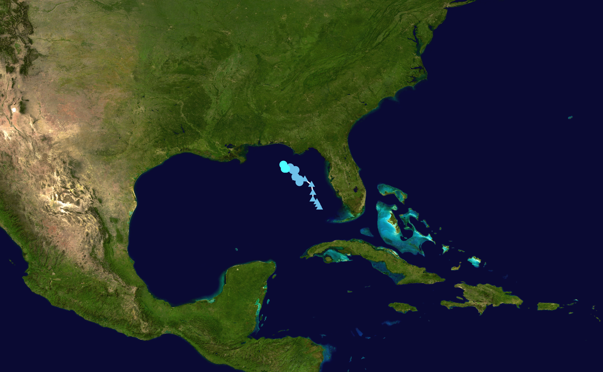
Tropical Storm Bertha is not headed for north Georgia. As of Tuesday, July 21, the storm sat roughly 70 miles south-southwest of Panama City, Florida, moving northwest at 5 mph with maximum sustained winds of 50 to 60 mph. It is the second named storm of the 2026 Atlantic hurricane season.
NWS Meteorologist Meredith Wyatt told Patch on Tuesday, July 21, that south Georgia could see more cloud cover and rain from Bertha's proximity, but the metro Atlanta risk comes from the storm's moisture feeding into a separate frontal boundary overhead.
Rain not done after Wednesday
The NWS extended forecast shows elevated rain chances continuing: 80 percent Thursday, July 23, through Saturday, July 25, before dropping to 30 percent Sunday, July 26.
What residents should do
The Georgia Emergency Management and Homeland Security Agency maintains flood safety resources at gema.georgia.gov/floods-and-flash-floods. Residents can monitor for upgraded watches or warnings through the NWS Peachtree City office at weather.gov/ffc.
According to the NWS, six inches of fast-moving water can knock a person off their feet, and 12 inches can carry away a vehicle. Drivers should avoid any flooded roadway.